The information on this page was correct at the time of publishing (July 2023). The project has since evolved and we would encourage you to read our September update for more information.
Project description
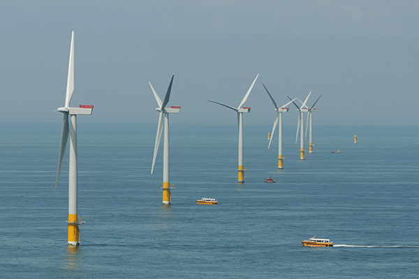
North Falls has an offshore array area of 150km2 split into two sections within the Outer Thames Estuary, in the southern North Sea. Its closest point to land is 22.5km from the East Anglia coast near Orford.
The current proposals for North Falls include up to 72 wind turbines on fixed foundations, the design of which is still to be determined but could include: monopile, suction bucket, gravity base or jacket. Array cables will connect the turbines in strings to either one or two offshore substation platforms, also on foundation(s). These contain electrical equipment and ancillary components to transform the voltage of the electricity generated by the turbines, so it can be transported either to the onshore transmission network or to an offshore connection point. Scour protection would be placed around the base of each of the foundations and seabed cables as required.
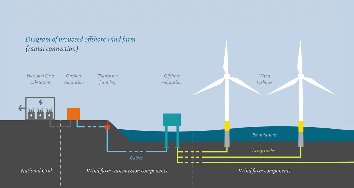
A subsea interconnector will join the project's northern and southern sections. In the event of an onshore grid connection, subsea export cables will bring the power to shore at a location known as 'landfall'. From there, underground onshore cables would carry the power to a new onshore substation and then on to the national grid.
At this stage of the project some optionality is required to future proof the development consent order and therefore a 'design envelope' approach has been adopted. The design envelope includes maximum and minimum parameters to be fully transparent and ensure that the worst case scenario is quantified and assessed.
The full project description can be found in the PEIR chapter:
North Falls project at a glance
| Infrastructure | Feature | Parameter |
|---|---|---|
|
Array |
Total array area |
150km2 |
|
Northern array |
20.9km2 |
|
|
Southern array |
128.6km2 |
|
|
Closest distance to shore |
22.5km |
|
|
Water depth relative to Lowest Astronomical Tide |
5 to 59m (30m mean) |
|
|
Turbines |
Maximum number of turbines |
72 |
|
Maximum turbine rotor diameter |
337m |
|
|
Maximum rotor tip height (above Mean High Water Springs (MHWS)) |
397m |
|
|
Minimum clearance above sea-level (above MHWS) |
27m |
|
|
Minimum separation between turbines |
1150m downwind, 820m cross wind |
|
|
Offshore subsea cables |
Offshore cable corridor length |
57km |
|
Maximum number of offshore export cable circuits |
4 |
|
|
Maximum array cable length (includes interconnector cable) |
228km |
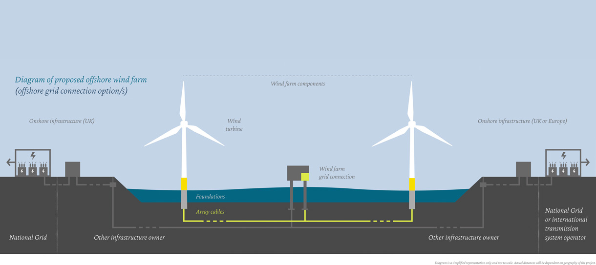
Connection options
One key area of optionality is around connection to the national grid. North Falls is committed to working with the Department of Energy Security and Net Zero to explore grid connection options as part of the Offshore Transmission Network Review (OTNR) process and as such has committed to exploring coordinated network designs, along with four other projects in East Anglia.
This means we are currently reviewing three options for the electrical infrastructure:
-
Option 1: Onshore electrical connection at a National Grid connection point within Tendring, Essex, with a project alone onshore cable route and onshore substation infrastructure;
-
Option 2: Onshore electrical connection at a National Grid connection point within Tendring, Essex, sharing all or part of an onshore cable route with separate onshore export cables with another project (such as Five Estuaries) where practicable, or;
-
Option 3: Offshore electrical connection supplied by a third-party electricity network provider. Such a connection will potentially be identified through the OTNR process.
Offshore works
The North Falls array area, where the turbines and offshore substation platform(s) will be located, is split into two boundaries separated by a shipping route. The northern and southern array boundaries cover areas of approximately 21km2 and 129km2, respectively.
Prior to offshore construction, pre-construction surveys would be undertaken to plan potential minor siting adjustments and identify whether unexploded ordnance and boulder clearance is required. Any other seabed obstructions such as discarded fishing gear or abandoned cables would also be removed.
Offshore construction should take around three years however the programme can be affected by the final design and layout of the components, supply chain and weather conditions during the work.
Onshore works
North Falls' onshore infrastructure is proposed to be located entirely within Tendring, Essex. Its footprint is referred to as the 'onshore project area' with the exact siting of the infrastructure being refined through site selection, and with consideration given to consultation feedback and data from our surveys. There are three key areas that make up the onshore project area as follows:
- Landfall
- Onshore cable corridor
- Onshore substation
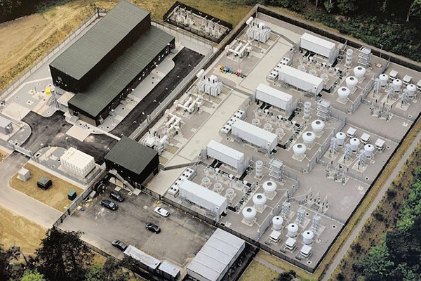
Above: Greater Gabbard Substation
For more information about the project's design strategy for the onshore substation, please see the PEIR document:
Above: Onshore AC cable corridor for Sofia Offshore Wind Farm
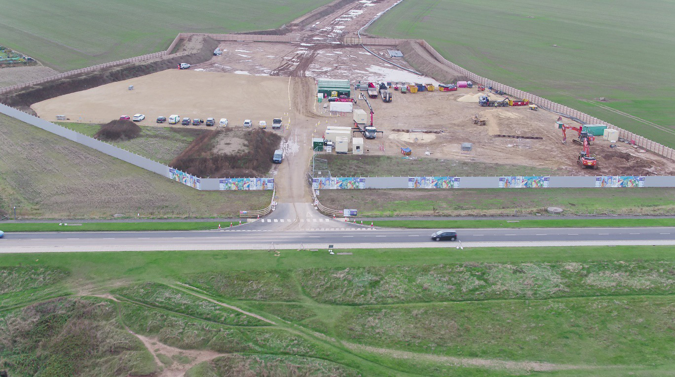
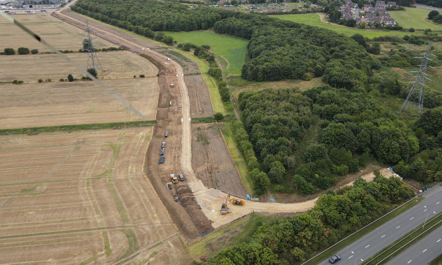
Above: Landfall construction compound (Sofia and Dogger Bank C)
Feedback Questions
A number of responses to this question reiterated the message that an offshore connection would be preferred, negating the need for landfall here. However there were a handful of specific comments and queries related to the existing proposed location that the project will assess, for example around flooding, horse livery and local traffic. There was a suggestion to avoid the golf course as a site for the temporary construction compound (the cable will go underneath the golf course and it will not be used as a temporary construction compound) and also to work with local cycling groups.
Comments supplied to this question offered some useful insights, particularly related to the section around Thorpe-le-Spoken where there are varying constraints related to each option proposed currently. Some preferences for the northern route and some for the southern. These will be reviewed collectively to determine the most feasible way forward. Traffic volumes have been brought up as a concern, around Thorpe-le-Soken and also Kirby Cross. There was also specific mention of Great Holland Mill and a common theme was land drainage.
Other than further statements declaring a preference for an offshore grid connection, responses to this question ranged from requests to totally screen the substation from view by use of tall trees and vegetation, to ensuring all infrastructure (for example the National Grid and Five Estuaries substations) be located closely together. There were also suggestions to move the substation further inland (so the Norwich Tilbury route carried on on a straight line), or further to the east.
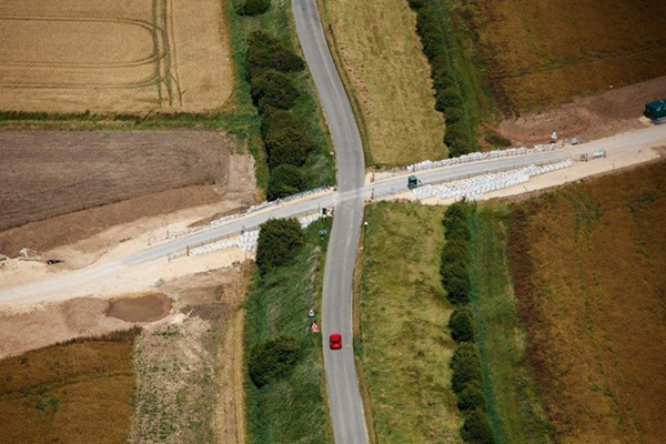
Landfall
The landfall is where the offshore export cables are brought onshore and connect to the onshore export cables within transition joint bays. It is likely to be located near Frinton-on-Sea with construction work being undertaken from a temporary compound within what we refer to as the landfall compound zone. A construction technique called horizontal directional drilling (HDD) will be used to install the cables at landfall. At our previous consultation we asked for any details that may help us to select the location for our temporary construction compound. This question remains as we are still to finalise the exact location of the construction compound.
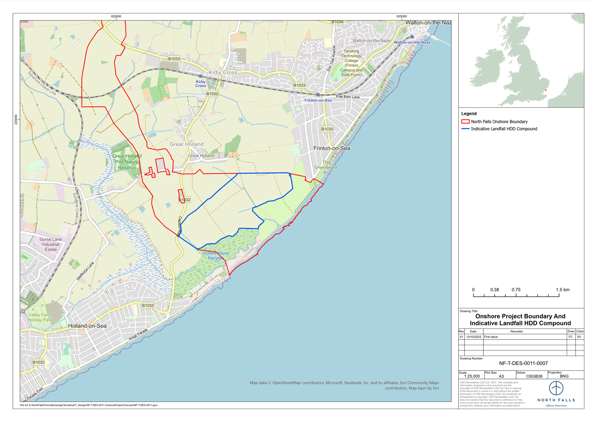
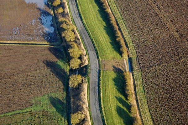
Onshore cable corridor
From the landfall, onshore export cables, laid in ducts along the cable route will carry electricity approximately 24 kilometres to the onshore substation. So far North Falls has identified broad onshore cable corridor(s) up to 243m in width, which will be refined down to a predominantly 60 metre-wide working width where the construction works for the onshore export cables will take place. Some sections may be wider to allow for more complex crossings such as railway lines, main roads or hedgerows. Some additional land adjacent to, or near, the cable corridor will also be required for temporary construction compounds.
At this stage the current corridor(s) still have a degree of flexibility and optionality. There will be further engineering design studies and ground investigation works, ongoing engagement with landowners and consultation feedback to take into account prior to the submission of the project's application. When it comes to construction, the export cables will be installed by open cut trenching, or trenchless techniques where needed, with land reinstated and returned to its former use after the work is completed with the exception of any land affected by permanent above ground infrastructure, specifically the onshore substation.
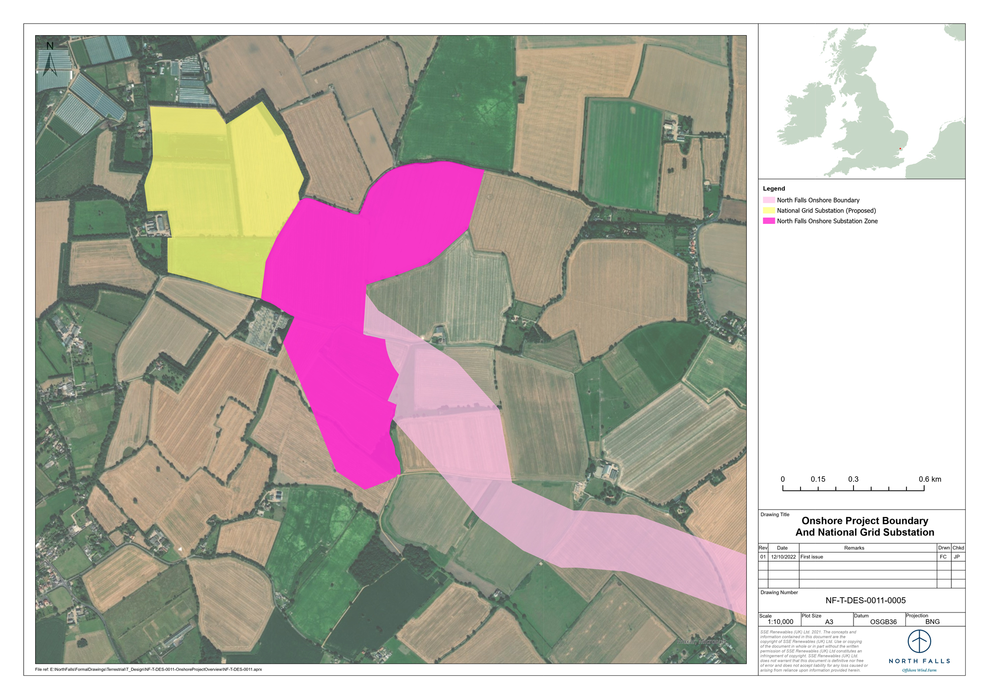
Onshore substation
Again, the precise location of the onshore substation and grid connection is subject to ongoing consultation, however assuming a radial connection, the substation will be located in the onshore substation zone (see map opposite). The onshore substation will feature either air insulated switchgear where the high voltage equipment is installed outdoors, or gas insulated switchgear where high voltage equipment is located within a building. In addition there would be drainage and access infrastructure, and extensive landscaping such as bunds, woodland and hedgerow planting. A maximum area of 0.080km2 (8ha) would be required for the onshore substation.
North Falls considered issues of good design from an early stage in the development of the project. Initially as part of the golden rules used for the site selection process but more recently through the preparation of a Design Vision Statement included as part of this consultation. This sets out the project's design strategy for the onshore substation, identifying the constraints and opportunities relevant for electrical infrastructure situated in the local landscape.
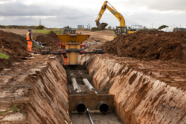
Onshore cable construction Sofia and Dogger Bank C
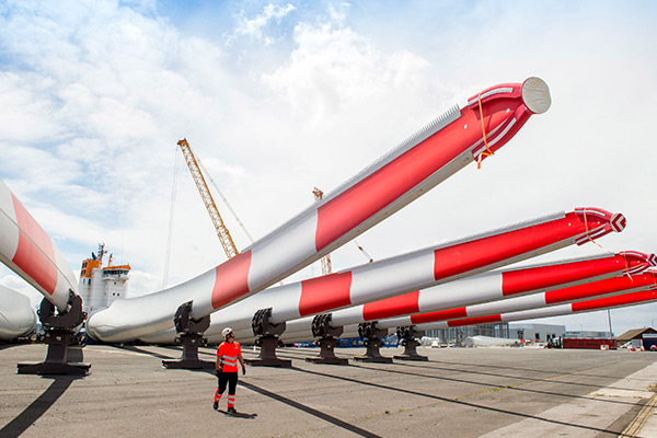
Recyclable blades for Kaskasi Offshore Wind Farm
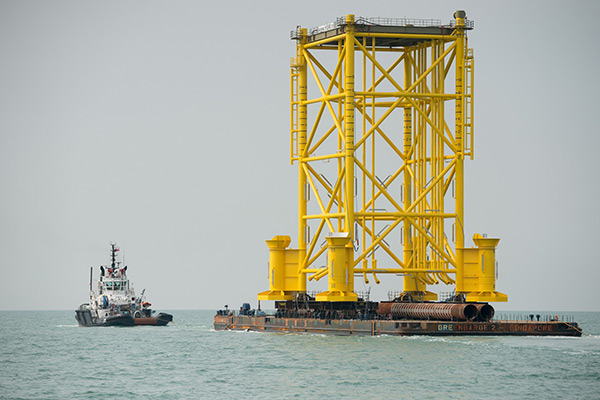
Substation jacket foundation at Rampion
Photos showing the onshore construction of Triton Knoll Offshore Wind Farm, which used similar techniques to those proposed for North Falls.
Before construction at Triton Knoll
During construction at Triton Knoll
After construction at Triton Knoll